Attention! The official website of the archaeological project of Sultana can be found here. This website is developed to publish some interesting spatial data. Please visit https://geo.hogent.be to learn more about our work.

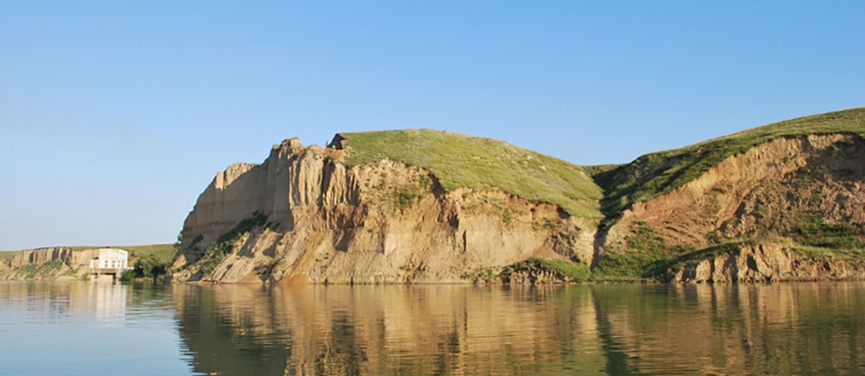
Localisation
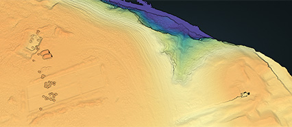
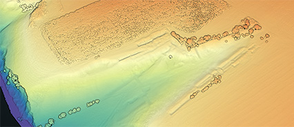
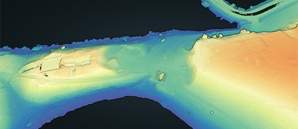
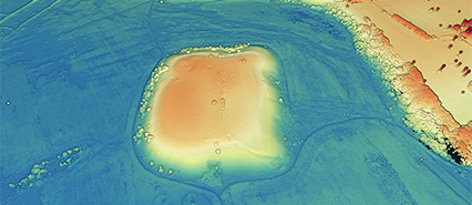
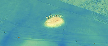
ALS (Airborne Laser Scanning)
Point clouds are available using entwine. Furthermore, the full datasets are available as compressed LAZ-files (site per site and strip per strip. Rasterized digital elevation models are provided via a WCS. All data are georeferenced in the Romanian Pulkovo 1942(58) / Stereo70 (EPSG:3844), but no point cloud classification has been applied.
The authors:
Dr. Cornelis Stal: HOGENT University of Applied Sciences and Arts
Drs. Cristina Covataru: University of Bucharest, ArchaeoSciences Division
Dr. Catalin Lazar: University of Bucharest, ArchaeoSciences Division
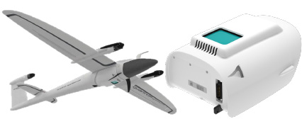
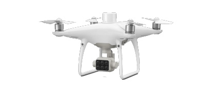
MS (multispectral) mapping
In this section, you can find some results of data acquisition using a UAV with a multispectral sensor (DJI Phantom 4 Multispectral). True color composites, false composites, and SVF maps (sky view factor, calculated using unclassified ALS data) are presented using leaflet.
All data are available through an XYZ-file service, which can be using in other desktop GIS software as well. The menu below allows you to generate an URL for a specific dataset.
Some recent publications
Stal, C., Covataru, C., Müller, J., Parnic, V., Ignat, T., Hofmann, R., & Lazar, C. (2022). Supporting Long-Term Archaeological Research in Southern Romania Chalcolithic Sites Using Multi-Platform UAV Mapping. Drones, 6(10), 277.
read
more →
Covătaru, C., Stal, C., Florea, M., Opriș, I., Simion, C., Rădulescu, I., ... & Lazăr, C. (2022). Human Impact Scale on the Preservation of Archaeological Sites from Mostiştea Valley (Romania). Frontiers in Environmental Science, 10, 924440.
read
more →
3D Models
Since the start of the partnership between the authors of this website, intensive work has been organized on image-based 3D modelling of the various sites in the region. A small selection of the resulting models is presented here using 3DHOP as interactive model viewer.
Partners